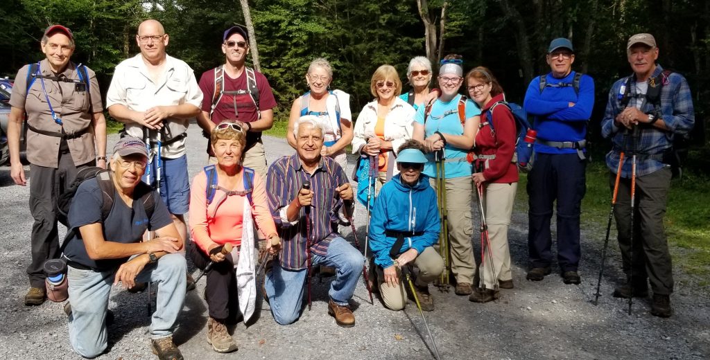
Fifteen of us hiked briskly to the lean-to at Bear Lake near McKeever with everyone making it. It was a gorgeous day with temps in the low 70’s, hiking approx 5.5 miles round trip. A prior attempt on snow shoes resulted in less than perfect results and a rep that Sharon says is unshakeable. Lunch at the lean-to was nice with minimal bug annoyance and then we hiked back.
While heading back, Dick lent his “leatherman” to another hiker to remove a fishing hook from his dog that was swimming in the lake. At the same time a group of hikers with their dogs were passing by with one happening to be a veterinarian who also aided assistance.
Write-up: Walt Pillar Leader: Walt Pillar Co-Leader: Jim Wazielewski
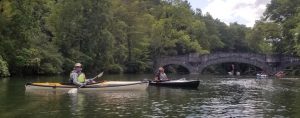
13 of us (10 Tramps, 1 newbie and 2 interlopers) paddled 6.5 miles from the launch on Brookwood Point to the Stone Bridge on the Susquehanna, back up the lake to Kingfisher Tower and stopped for lunch at the Blue Mingo Café before returning to Brookwood Point.
The weather was great but the lake was choppy; company was great. Blue shirts were the uniform of the day.
Write-up: Mary Pat Connors Leader: Mary Pat Connors Co-Leader: Madonna Fellows
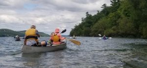
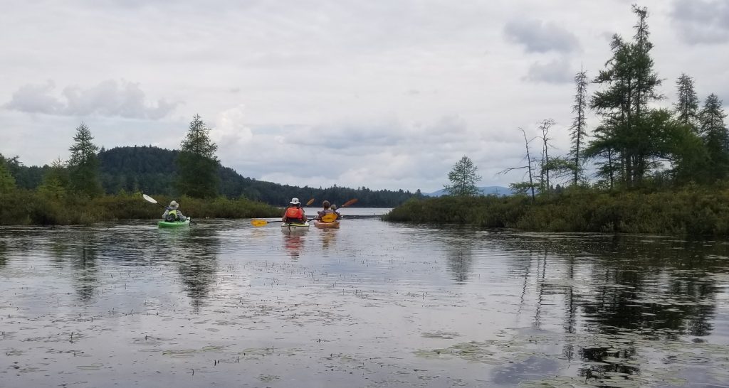
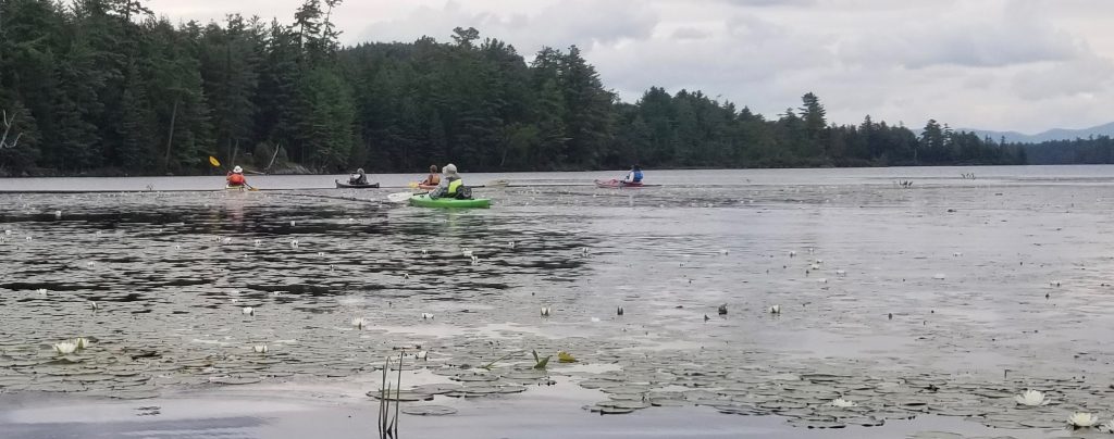
The weather forecast was iffy, but seven Tramps took the chance on going the distance to Forked Lake. We put in at Whitney Point, toward the western end of Forked Lake, in order to be closer to the outlet to Brandreth Lake.
We agreed to explore Brandreth Lake outlet as far as we could without going over a beaver dam. We saw several beaver lodges, but were able to paddle a good way before turning around.
The lake was very pretty and peaceful with only a few kayaking and a few fishing. The south shore has only campsites, and the north shore is privately owned by the Whitney family.
We paddled toward Little Forked Lake which is privately owned, to check out the cable marking private property, but the clouds that had been following us, were getting darker, so we headed back.
We were able to disembark and load kayaks without a drop. As we drove down N. Point Rd., you could see that it had rained there but not at our end. Someone was watching over us. We did hit torrential rains driving down Rt. 28, but missed the floods that were occurring in Utica, due to our lengthy stop at Kratzy’s for food and beverage.
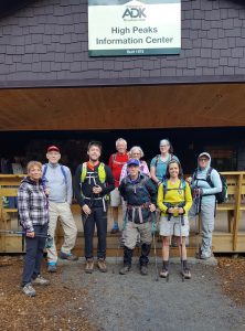
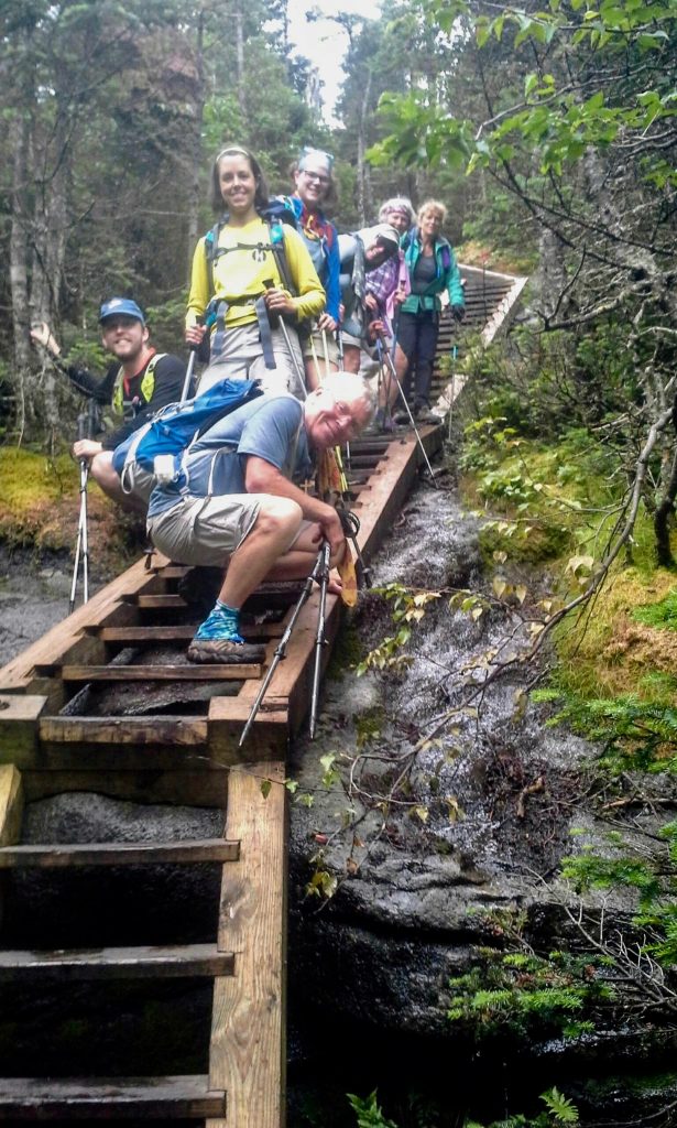
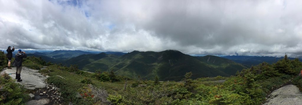
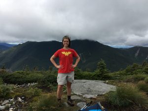
Our group met very early in the morning at the ADK LOJ. Sir Tom Smith, his daughter, son-in-law and Hugh went on ahead of us at a faster pace. Geoff Horan, a kind and gentle man, was our leader, making me feel this would be a pleasant walk. The other time I did Colden, it rained all the way up, all the way back and we were in a cloud at the top with NO view. I’d heard there was a beautiful view, but had never had the pleasure of seeing it. Rain was predicted for later in the day and Geoff had trained for this hike. Five miles a day at a 15 minute mile pace. He was on fire! He wanted us off the highest, steepest part before the rain. A few hikers missed the turn for the summit, but a quick “Marco Polo” call got them back on track. The view from the top was magnificent. The air was clear. The clouds and mountains were spectacular. It was very windy and freezing, so we got off the summit and out of the wind for a rest and lunch before we started down.
Aspiring Tramp
Great planning by Geoff. Just as we got back to the Lake Arnold Trail it started to rain a bit. Our hike back to camp was uneventful. Rain coats on. Raincoats off. To top it all off, we made it back to camp by happy hour and dinner.
6.3 mi. ascent (via Lake Arnold Trail) to the 4714′ summit.
Indian Pass to Wallface Mountain Write-up: Lu Blanchard
Seven of us hiked the Indian Pass into Wallface Mtn. and it was more exciting than we anticipated! We had hiked in from Tahawus with Meg H. years ago and I remembered the rock jumbles on that side and wanted to see what this side was like. The day started cool so we passed by Rocky Falls without stopping thinking we may be able to take a dip on the way out if the day warmed up. The trail was pretty easy to the Falls, which is about half-way in. After many stream crossings we began to climb a bit more steadily and as we were within about one-half mile from the trail summit the trail became a stream bed with rock, water and downed tree obstacles around which we had to navigate. We were all glad we had poles, although sometimes on the way back down it was easier to throw them down and just slide down to the next level! We were definitely in a “pass” and the beauty of the surrounding rocks and cliffs was astounding. We felt small and insignificant, like ants on a boulder, compared to the power around us. Upon reaching the summit we discovered a true “Summit Rock” complete with marker and ate lunch while facing the precipice of Wallface Mtn. The jumble of rocks at the bottom was covered with different covered moss, some even looked like fur, and we imagined wild animals sleeping on the ledges or in the many caves below. Hiking back was a piece of cake after we descended the creek bed, but unfortunately the day did not warm so there was no swimming in the falls. The hike was between 10-12 miles depending on whose GPS/smart watch you wanted to believe.
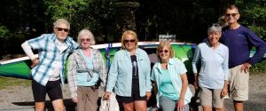
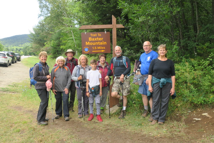
Baxter Mountain Write-up: Mary Pat Connors
A small group of us decided to do a small mountain with a big view. I can highly recommend Baxter Mountain for almost all abilities. There are “gentle switchbacks” (as per review) winding upward with a pretty good rock scramble at the end. Very nice view, exceedingly pleasant hiking. A few continued on to Snow Mountain, which apparently was NOT as easy. I think I heard a couple “Holy S**ts” in their description.
Baxter Mt.: 1.5 miles to the 2,440 foot summit. Total: 3 miles. Snow Mt. : 2.6 mi to 2370 summit. Total: 5.2 miles.
 Fifteen of us hiked briskly to the lean-to at Bear Lake near McKeever with everyone making it. It was a gorgeous day with temps in the low 70’s, hiking approx 5.5 miles round trip. A prior attempt on snow shoes resulted in less than perfect results and a rep that Sharon says is unshakeable. Lunch at the lean-to was nice with minimal bug annoyance and then we hiked back.
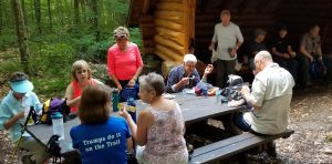
 While heading back, Dick lent his “leatherman” to another hiker to remove a fishing hook from his dog that was swimming in the lake. At the same time a group of hikers with their dogs were passing by with one happening to be a veterinarian who also aided assistance.
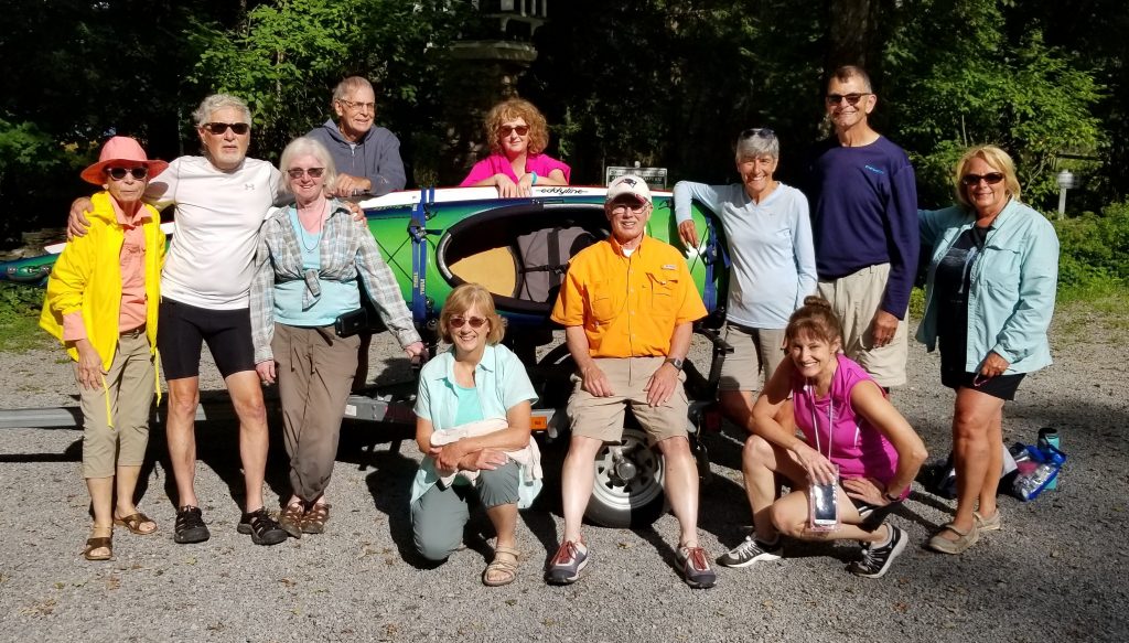 13 of us (10 Tramps, 1 newbie and 2 interlopers) paddled 6.5 miles from the launch on Brookwood Point to the Stone Bridge on the Susquehanna, back up the lake to Kingfisher Tower and stopped for lunch at the Blue Mingo Café before returning to Brookwood Point.
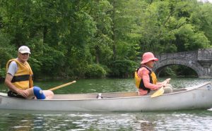

 A small group of us decided to do a small mountain with a big view. I can highly recommend Baxter Mountain for almost all abilities. There are “gentle switchbacks” (as per review) winding upward with a pretty good rock scramble at the end. Very nice view, exceedingly pleasant hiking.